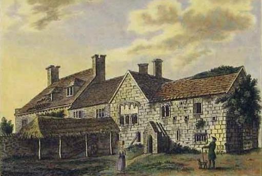
Somerford Grange
For maps showing the changes through the years, click here
The area currently known as Somerford is to the east of Christchurch. At the time of Edward the Confessor (1042-1066), the area was part of 'Stanpeta' (meaning 'two estates with meadows'), the Somerford area being owned by Wislac. After the Norman conquest, the area was owned by Hugh de Port who was a feudal lord in Hampshire, having been given several estates as a reward for "slaying so many English" in battle. In 1140, an area of some 150 acres at Somerford was conveyed to Christchurch Priory. The grange was built in the middle ages as a farm house associated with Christchurch Priory, and in the 16th century was the home of John Draper, the last prior of Christchurch Priory. Somerford was identified in the surrender document of the Dissolution of the Monasteries in 1540 at which Somerford became the property of The King, but John Draper continued to live here until his death in 1552. The estate (Manor) covered an area centred on what is now the BAe Systems site and extending to the New Forest boundaries. On the death of John Draper, Somerford Manor was conveyed by King Edward VI to his uncle, Sir Henry Seymour and subsequently changed hands many times, at least part of it eventually becoming the Meyrick estate. Somerford Farmhouse was in the possession of the Goldwyre family, and in 1781 was owned by Gustavus Brander who rebuilt it, and it stayed in the possession of the Brander family, being owned by another Gustavus Brander in 1912. (A Thomas Brander died there in 1861 when it was called Somerford Grange.)
|
Somerford Grange |
The site of Somerford
Grange and associated farm buildings were located in what is now the
woodland next to the present Sports &
Social club in Grange Road. The area to the west of the Grange was
originally a quagmire, but was drained by the monks and then contained a
lake which was constructed by the monks to provide the estate with fish.
The river Mude runs through this area which became Somerford Wood.
The lake can still be seen in the green belt land. For maps showing the changes through the years, click here |
The last remnants of Somerford Grange were demolished in 1938 to make way for housing when MOD acquired the land to the east of the de Havilland airfield for use as the Air Defence Research & Development Establishment (ADRDE) site at which the new home defence radar systems could be developed. However, one of the outbuildings of 'The Grange' survived and was in use by Christchurch Council as a storage area. This was demolished around 1997. During the war, it was realised that the ADRDE site was vulnerable to attack by German bombers and so the activities were transferred to Malvern combining with the Telecommunications Research Establishment (TRE) to form the Radar Research Establishment (RRE). RRE was renamed the Royal Radar Establishment in 1957. The Somerford site was then occupied by the Signals Research Development Establishment (SRDE) which moved down from Woolwich where it had suffered from air raids.
 Behind the wood is Fisher's field, bordering Somerford Road. |
During the 1920s, the
area to the west of what is today the British Aerospace site was part of Mudeford
Farm, owned by Mr. Burry. In June 1926 "Burrys Field" was used
by Surrey Flying Service. This is now the Airfield Industrial Estate.
The field to the east of that original airfield was part of Somerford
Grange Estate and was used by Mr. Fisher for air pleasure flights and an
'Air Circus' until 1933. This was known as Fisher's Field or Somerford
Bridge, which later became part of the Airspeed factory which later
amalgamated with DeHavilland. These two fields became BOURNEMOUTH
AERODROME with scheduled services and a flying club. The Airspeed
factory was later built on the east end of site in Somerford Road. |
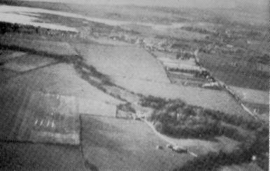
During the 1939-1945 war, the area between the original airfields and Bure Homage (a mansion house between the airfields and the coast), was requisitioned by MOD for use as a D day airfield in 1944. This had a grass runway.
In 1954 the grass runway was converted to a hard runway by the Military Engineering Experimental Establishment. Although flying ceased officially in 1964, the wartime runway was used in the sixties as an airfield for light aircraft and gliders (with a winch tow) until 1972. This was then sold for more housing and the change to the road layout, the road approximately covering the area of the old runway still being called 'The Runway'.
|
View taken around 1970 showing SRDE (now BAe) site with runway and Isle of Wight in the background |
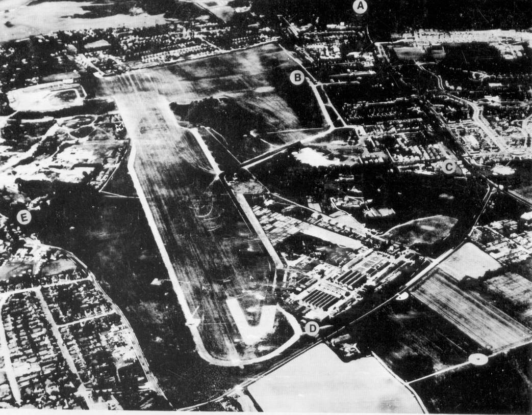
This photograph shows the hard runway just before it was sold. The photo also shows the white Radome on the SRDE ground on the cliff top at Steamer Point. This Radome dates from 1965 and housed a 40 ft diameter dish which was used to track both British and foreign satellites. It was later used as a test station for the first British Skynet military communications satellite system, later groundstations being in Cyprus and Singapore. |
|
|
Prior to 1974, the area was part of the county of Hampshire which extended westward to include Bournemouth (but not Poole) but in 1974 the boundaries were changed such that the area is now the eastern extremity of Dorset.
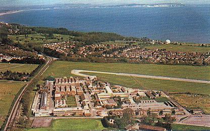
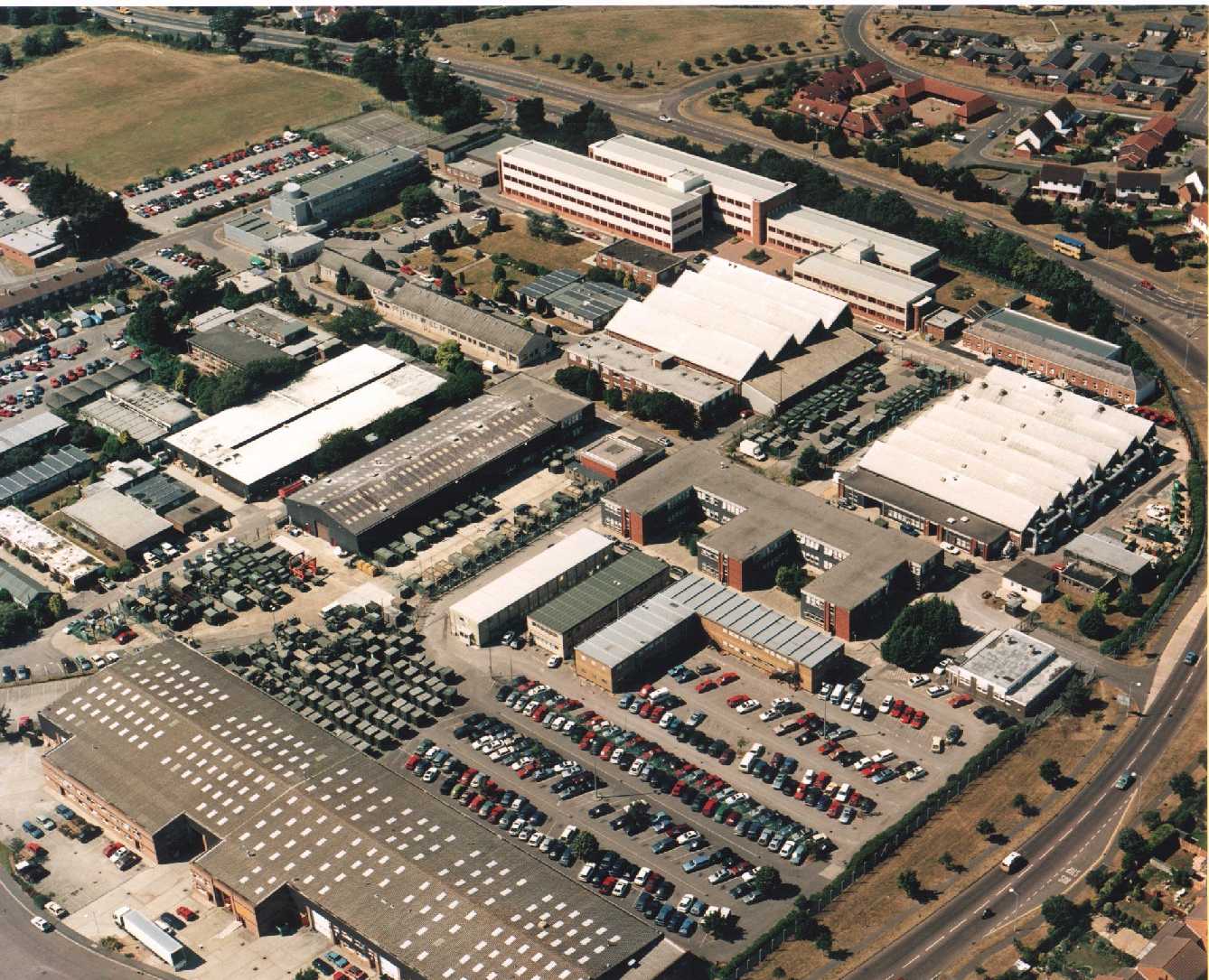
When SRDE moved out in 1980 to combine with RRE at Malvern to become the Royal Signals and Radar Establishment (RSRE), that part of the MOD site not sold for redevelopment was leased and then sold to the Plessey company. The site provided the development and production facilities for the Switch which is part of the Ptarmigan military tactical communications system for the British Army. The first Plessey staff transferred from the Plessey site at Poole, but later were joined by the Ptarmigan system design staff from Plessey at Roke Manor. Over the years, other projects were moved to the Christchurch site. In 1990, the site became Siemens on the acquisition of Plessey by Siemens/GEC, and subsequently became British Aerospace in 1998 and now BAE SYSTEMS. Since 2004, the site has been shared between BAE Systems, Selex Communications and part leased out as office space.
When SRDE moved out, the 'Steamer Point'
property was sold for Housing, car park and the Coast Guard station, the
woodland being preserved for recreation.
For the Bure Homage specific aspects see BureHomage.htm
For maps showing the changes through the years, click here
For a view of the BAE Systems Christchurch site in 1999, click here.
For an aerial view of the area, click here.
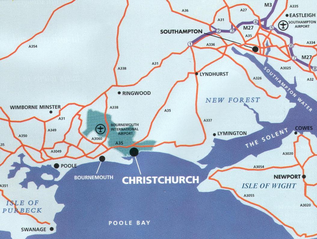
For a route map of the area click here
For the SRDE website, click here and for the SRDE history, click here
For more information about Christchurch Airfield, click here.
For a site showing a history of Highcliffe, click here
(some of the early history and drawings are taken from a guide 'Bure Homage, Mudeford' written by Olive Samuel in 1985, 'Christchurch Airfield (40 Years of Flying)' by Allen White and 'Christchurch Pictorial History' by Christine Taylor)
Barrie Wells
Generated 22nd June 1998
updated 4th June 2006
For comments and/or disagreements mail me