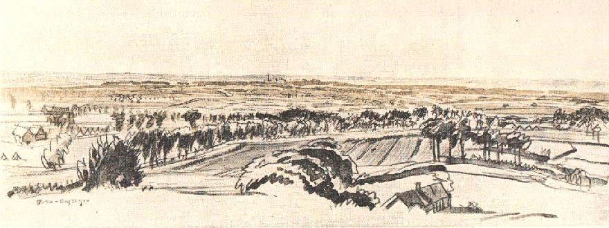
The Landscape of Flanders - a Distant View of Ieper (Ypres) from the South West
This view of the Flanders landscape (executed in 1916 by Muirhead Bone, a war artist who was later knighted, for the series published as a part work by Country life magazine) is from a view point 'some six miles South West of Ypres. The ruins of the Cloth Hall tower can be seen in the centre, the village Hooge (not seen) is a little to the right and Zillebecke further to the right. The artist tells us that Dickebusch (modern spelling Dikkebus) is midway between the viewpoint and Ypres. This would mean that the observation point is somewhere in the region of the village of Kemmel, perhaps on the Kemmel Berg. The high ground on the horizon, represents the German positions in 1915, which swung in an arc round the ancient city of Ieper (Ypres) and created The Salient, the bulge in the British line dominated by the encircling Germans on the crescent of high ground.
Click on the image for an enlarged version